Weather
Alert Issued for Coastal Hazards in Puerto Rico and the U.S. Virgin Islands

The National Weather Service has sounded the alarm for Puerto Rico and the U.S. Virgin Islands, warning of coastal and marine dangers set to impact the areas from April 9 to April 13. The advisories underscore the risks of tumultuous seas and vigorous winds that could challenge the safety of those on small vessels and individuals planning to visit the beaches.
During the interval from Tuesday to Friday, the seas are anticipated to swell to heights of 8 feet, with the force of the waves reaching similar peaks. Winds are expected to surge, blowing steadily at speeds of 15 to 20 knots and gusting up to 30 knots. A marginal easing is predicted by Saturday, with sea levels possibly reducing to 7 feet and wave heights to 5 feet, while winds could maintain their intensity but with gusts slightly decreasing to 25 knots.
The current maritime forecast has initiated advisories for hazardous seas for small crafts, which could extend over the week, alongside a pronounced warning of high-risk rip currents. These currents are deemed perilous, capable of overpowering even adept swimmers and making it difficult for them to safely return to shore.
The tumultuous conditions are a result of northerly swells paired with moderate to locally intense trade winds. The anticipated hazardous seas are set to affect the offshore Atlantic waters by Tuesday evening, progressively reaching the northern coastal waters of Puerto Rico and the U.S. Virgin Islands, encompassing the Mona and Anegada Passages, by Wednesday. Although advisories for small crafts are in effect until late Thursday night, the expectation is for these challenging conditions to linger into the weekend.
The onset of life-threatening rip currents is also forecasted, starting from northern Puerto Rico by Tuesday evening and expanding to western Puerto Rico, Culebra, and the northern reaches of the USVI by Wednesday. The high risk associated with these rip currents is projected to last until late Thursday night, with a continuation of the hazardous conditions likely through the weekend. Wednesday could also see heightened surf conditions.
The National Weather Service cautions against the potential repercussions, which span hazardous seas for small crafts, rip currents with the power to drag swimmers into deeper waters, perilous surf and swimming conditions, and the risk of localized coastal flooding and beach erosion. It’s crucial for both residents and visitors to heed these warnings, remain vigilant, and stay updated on weather developments throughout this period.

The U.S. Virgin Islands is known for its stunning beaches, lush landscapes, and year-round sunshine, making it a prime destination for tourists seeking a tropical paradise. But what makes the USVI’s climate so unique? To understand the science behind this region’s tropical weather, we must explore a combination of geographical location, ocean currents, and atmospheric conditions that shape the islands’ environment.
Location and Latitude: The Tropical Zone
The USVI is located in the Caribbean, just north of the equator, which places the islands within the tropical zone. This location is significant because the sun’s rays are more direct here than in temperate regions, leading to consistently warm temperatures throughout the year. The islands sit between 17°N and 18°N latitude, which means they experience minimal variation in daylight hours compared to regions farther north or south.
The average temperature in the USVI ranges from 77°F (25°C) to 88°F (31°C) depending on the time of year. Even during what is considered the “winter” season, temperatures remain warm, allowing for comfortable conditions year-round. The proximity to the equator also means that the islands do not experience extreme seasons like those found in temperate climates.
Ocean Currents: A Natural Climate Moderator
The surrounding waters of the Caribbean Sea and the Atlantic Ocean play a critical role in moderating the climate of the USVI. Warm ocean currents, such as the Gulf Stream, help to maintain consistent temperatures by transferring heat from the tropics to higher latitudes. These currents also create a buffer against drastic changes in temperature, making the climate relatively stable.
The warm waters around the USVI contribute to the high humidity levels often experienced on the islands. This humidity, combined with the tropical heat, can make the air feel warmer than the actual temperature. However, the trade winds that blow across the islands help to alleviate some of the discomfort by providing a cooling breeze, especially along coastal areas.
Trade Winds: The Islands’ Natural Air Conditioning
Trade winds are another key component in shaping the tropical climate of the USVI. These steady, easterly winds blow from the northeast and provide a natural cooling effect, especially during the hotter months. The trade winds are a result of global atmospheric circulation patterns caused by the earth’s rotation and the heating of the equator.
These winds not only cool the islands but also contribute to the relatively stable weather patterns. While hurricanes and tropical storms are a concern during the Atlantic hurricane season, the USVI often experiences more moderate weather due to the trade winds’ influence. The winds help to steer tropical storms and hurricanes away or reduce their intensity before they reach the islands.
Rainfall Patterns: Wet and Dry Seasons
While the USVI enjoys sunny days most of the year, it is also subject to a tropical climate’s typical rainfall patterns. The islands experience two distinct seasons: a wet season and a dry season. The wet season typically runs from June to November, coinciding with the Atlantic hurricane season, while the dry season occurs from December to May.
During the wet season, the islands receive the majority of their annual rainfall, which averages around 40 inches per year. The showers are often short but intense, followed by sunshine. The dry season, on the other hand, sees less frequent rain, and the lush greenery of the islands can become more arid. Despite this, the trade winds continue to bring moisture, keeping the islands relatively humid throughout the year.
The Impact of Climate Change
In recent years, the effects of climate change have become increasingly evident in the Caribbean, including the USVI. Rising sea temperatures, more intense hurricanes, and changing rainfall patterns are some of the consequences that scientists have observed. As the planet warms, the frequency and intensity of extreme weather events are expected to increase, posing challenges to the islands’ infrastructure and ecosystems.
Local initiatives are being taken to address these issues, such as developing more resilient infrastructure and protecting the islands’ natural resources. Understanding the science behind the USVI’s tropical climate can help in creating solutions that preserve the islands’ natural beauty and protect them from the impacts of climate change.
The tropical climate of the USVI is a result of its prime location, the influence of ocean currents, trade winds, and its proximity to the equator. This combination creates a paradise for residents and visitors alike, with warm temperatures, refreshing breezes, and abundant sunshine. However, the increasing impacts of climate change underscore the importance of preserving the natural environment that makes the USVI so unique. By understanding the science behind the islands’ climate, both residents and tourists can appreciate the delicate balance that sustains this tropical haven.

Staying up-to-date with accurate weather information is essential for residents of the U.S. Virgin Islands (USVI) due to the region’s frequent exposure to tropical storms and fluctuating weather patterns. Here’s a rundown of the top weather apps that offer tailored solutions to meet the unique needs of USVI residents:
1. The Weather Channel
One of the most reliable and widely-used apps, The Weather Channel provides detailed forecasts, including real-time radar imagery and severe weather alerts. It is particularly useful for tracking tropical storms, which are common in the Caribbean. With its customizable notifications and accurate hourly and daily forecasts, USVI residents can stay prepared, whether they are planning a beach day or bracing for an incoming storm. The app also offers hurricane tracking, making it a valuable tool during hurricane season.
2. AccuWeather
Known for its highly accurate live forecasts, AccuWeather is another popular option for islanders. It features real-time weather updates, minute-by-minute precipitation forecasts, and localized radar maps. The app’s “RealFeel” feature provides insights into how the weather feels in real-world conditions, which can be helpful in the tropical humidity of the USVI. AccuWeather also offers detailed alerts for extreme weather, including tropical storms and hurricanes, making it indispensable for keeping safe during the storm season.
3. Windy
For USVI residents, where wind conditions play a critical role in daily activities like boating or outdoor sports, Windy is a must-have. Windy offers a sophisticated visualization of wind patterns, helping users track wind speed and direction in real-time. The app’s interactive map gives a comprehensive view of weather systems moving across the Caribbean, ideal for both weather enthusiasts and casual users who want to keep an eye on changing conditions.
4. Weather Underground
Offering hyper-localized weather reports, Weather Underground is favored for its crowd-sourced data, which is collected from a network of personal weather stations around the world. USVI residents benefit from its radar imagery, storm-tracking features, and severe weather alerts. Its accuracy and real-time updates make it a useful resource for monitoring local conditions, particularly during the hurricane season.
5. Yahoo Weather
For a more visually appealing experience, Yahoo Weather delivers beautiful, animated backgrounds that reflect current weather conditions. The app includes detailed forecasts for up to 10 days, interactive radar maps, and information on wind speed and pressure. It’s a simple yet functional tool that can help residents stay aware of weather changes, without the clutter of advertisements or unnecessary features.
6. CARROT Weather
For those looking to inject some fun into their daily weather checks, CARROT Weather combines accurate forecasts with humor. In addition to providing reliable weather data, including hourly and daily forecasts, it features quirky commentary and interactive widgets. CARROT Weather is customizable, allowing USVI residents to focus on the details that matter most—such as storm alerts and temperature shifts—while enjoying a bit of entertainment.
7. NOAA Weather Radar
The NOAA Weather Radar app pulls data directly from the National Oceanic and Atmospheric Administration (NOAA), offering USVI residents real-time radar and satellite images, hurricane trackers, and marine conditions. This app is especially useful during the Atlantic hurricane season, providing critical information about approaching storms.
For USVI residents, reliable weather apps are essential tools for staying informed and safe in an environment prone to sudden weather changes. Whether you’re preparing for hurricane season or planning a weekend outing, using the right weather app will ensure you have the most accurate and timely information at your fingertips. Consider your specific needs, whether it’s in-depth wind data from Windy or detailed storm alerts from The Weather Channel, to choose the app that best suits your lifestyle.
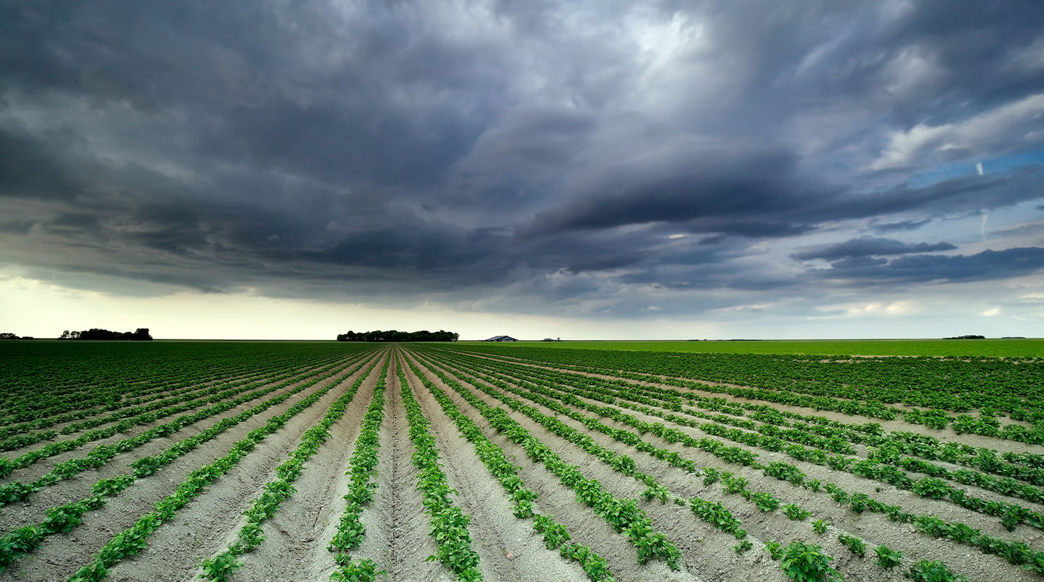
The agricultural sector in the U.S. Virgin Islands has long been shaped by the region’s tropical climate. Weather plays a critical role in determining the success or failure of crops and livestock, making it a central concern for local farmers. With the increasing unpredictability of climate patterns due to global warming, understanding how weather impacts agriculture in the USVI is essential to ensuring food security and sustainable farming practices.
The Role of Climate in USVI Agriculture
The USVI enjoys a tropical climate, characterized by warm temperatures year-round, with minimal seasonal variation. Rainfall patterns are less predictable, often fluctuating between periods of drought and heavy rainfall. These extremes pose a significant challenge to agriculture, as farmers must manage crops and livestock under constantly changing conditions.
Drought, in particular, has been a recurring issue in the USVI. The islands experience extended dry spells, especially during the late winter and early spring, which can severely affect crop yields. Water shortages make it difficult for farmers to irrigate their fields, leading to stunted growth and lower production. While the USVI does have water catchment systems in place, the reliance on natural rainfall for most crops makes drought a persistent threat.
Impact of Heavy Rainfall and Storms
On the other hand, periods of excessive rainfall can also have negative consequences. Heavy rains can lead to soil erosion, nutrient depletion, and waterlogging, all of which can harm crops. Tropical storms and hurricanes, which occur more frequently during the Atlantic hurricane season from June to November, bring additional risks. The strong winds and heavy rains associated with these storms can damage crops, uproot trees, and disrupt farming infrastructure.
For livestock farmers, heavy rains and storms can lead to increased risks of disease, as wet conditions create ideal breeding grounds for parasites and bacteria. Hurricanes, in particular, are a growing concern for farmers in the USVI, as these powerful storms can devastate entire farms, leading to substantial economic losses. Infrastructure, including barns, fences, and water catchment systems, often needs to be repaired or rebuilt after severe weather events.
Climate Change and Its Long-Term Effects
The increasing frequency and intensity of extreme weather events due to climate change are further exacerbating these challenges. According to climate projections, the USVI is likely to experience more prolonged periods of drought and more intense storms in the coming decades. Rising sea levels also pose a long-term threat to low-lying agricultural areas, increasing the salinity of soil and reducing its fertility.
Local farmers have already begun to see the impacts of these changes, with more frequent crop failures and livestock health issues. To combat this, many are turning to sustainable practices, such as crop diversification, water conservation techniques, and the use of climate-resistant crops. However, the financial and technical support needed to implement these strategies remains a barrier for many small-scale farmers in the region.
Solutions and Adaptation Strategies
Adapting to the changing weather patterns is essential for the future of agriculture in the USVI. One key solution is improving water management systems. Investing in rainwater harvesting, drip irrigation, and more efficient water storage systems can help farmers maintain crop production during dry periods. The USVI government and agricultural organizations have been promoting these practices, but wider adoption is necessary to make a significant impact.
Additionally, crop diversification is another important strategy for mitigating the risks associated with extreme weather. By planting a variety of crops, farmers can spread their risk and improve their chances of at least partial success during unfavorable conditions. Furthermore, introducing drought-resistant and flood-tolerant crop varieties can help farmers better withstand the challenges posed by changing weather patterns.
Research into climate-smart agriculture is also essential. Local universities, government agencies, and international organizations can collaborate to develop farming techniques that are better suited to the USVI’s unique climate. This could involve developing new crop varieties or researching alternative farming methods, such as hydroponics or vertical farming, which are less dependent on weather conditions.
Weather will always play a critical role in agriculture in the USVI, but the growing impact of climate change makes it even more important for farmers to adapt. The future of the islands’ agriculture depends on their ability to implement sustainable farming practices and manage the risks posed by extreme weather. By investing in water management, crop diversification, and climate-resilient farming techniques, the USVI can safeguard its agricultural sector against the unpredictable weather patterns that are becoming more common in the region.
This approach will not only help ensure food security for the islands but also support the local economy and preserve the livelihoods of the farmers who depend on the land.


The Intersection of Technology and Art in the U.S. Virgin Islands

USVI Festive Drinks and Cocktails: A Taste of the Islands

Travel Essentials for Your USVI Vacation

Education Board Seeks Input on Schools Through Comprehensive Survey

CTE Board Enthusiastic About New Curriculum Standards, Yet Anxious Over Apprenticeship Support

Registered Sex Offender Detained for Illegal Firearm Possession During Annual Surveillance Drive
-
 Education1 year ago
Education Board Seeks Input on Schools Through Comprehensive Survey
-
 Education2 years ago
CTE Board Enthusiastic About New Curriculum Standards, Yet Anxious Over Apprenticeship Support
-
 Crime2 years ago
Registered Sex Offender Detained for Illegal Firearm Possession During Annual Surveillance Drive
-

 Development1 year ago
Costs Surge as Donoe Estates Housing Project Resumes with New Contractor
-

 Videos3 years ago
2022 Gubernatorial Election: Voters Speak Out
-

 Videos3 years ago
Gubernatorial Teams Celebrate St. Croix’s Bull & Bread Day
-

 Videos3 years ago
Wakanda’s Female Might: A Dive into ‘Black Panther: Wakanda Forever’
-

 Crime2 years ago
St. John’s Westin Resort Scene of Armed Robbery, Prompting Heightened Police Vigilance